
Survey Orchestrator: AI Property Research & Quoting Platform
A custom AI platform that automates property survey order intake, multi-source research, and quoting across all 67 Florida counties, taking per-order processing from roughly 20 minutes of manual work to under 2 minutes.
The Challenge
Land surveying firms quote every job before they can schedule it, and quoting is research work. A single order requires copying details out of an email or portal submission, then checking the property across the county property appraiser, state cadastral records, and FEMA flood maps, then applying the firm's own pricing rules to whatever those sources turn up. Lot size, flood zone, structures, vegetation and the complexity of the legal description all move the number.
Done by hand that is roughly 20 minutes per order, every order, before a single field crew is dispatched. At meaningful volume it becomes a full-time research desk whose only output is a quote, and the delay in front of every quote slows the entire survey pipeline behind it.
Our Approach
The Survey Orchestrator runs on Anthropic's Claude as the agentic reasoning engine, ingesting and cross-referencing public and authoritative data sources to deliver automated property research and quoting at scale. The pricing layer is configurable, so each firm's own fee structure drives the output rather than a fixed model.
Implementation Phases
Incoming orders arrive through emails and portal submissions in dozens of unstructured formats. The system extracts property addresses, client details, legal descriptions, and special instructions from each document automatically.
Each property is validated and enriched across multiple authoritative data sources including state property records, county appraiser databases, and parcel registries to compile lot size, structure count, assessed value, legal description complexity, and parcel boundaries.
AI vision models analyze both satellite imagery and street-level photography for every property. Satellite views assess lot coverage, vegetation density, structures, driveways, fencing, and easement indicators. Street view images are analyzed for building condition, access points, terrain grade, and visible obstructions, surfacing complexity factors that would traditionally require a site visit or manual photo review.
FEMA flood map data is cross-referenced with property coordinates, parcel boundaries, and county-specific flood panel records to determine flood zone classification, replacing error-prone manual lookups.
The firm's own fee structure is expressed as a configurable model that reads the research output, including lot size, flood zone, vegetation density, structure complexity, legal description type and county requirements, and produces a quote with a confidence score, escalating anything non-standard to a human rather than guessing.
System Architecture
Email orders, portal submissions, property addresses
- Anthropic's Claude as the agentic orchestration engine, driving multi-step reasoning, tool use across data sources, and complexity scoring through the entire pipeline
- Document parsing and field extraction from unstructured order formats
- Multi-source property research across state records, county appraisers, and federal flood data
- Parcel ID search and flood zone determination
- AI vision analysis of satellite and street view imagery for property complexity assessment
- Configurable quoting model driven by each firm's own fee structure
- Standard vs. non-standard classification and escalation logic
- Enriched order records with complete property data
- Calculated quotes ready for staff review and delivery
- Flagged orders requiring manual review
All property data cross-referenced across multiple sources for accuracy. Orders are flagged automatically when data discrepancies are detected, and anything the system is not confident about goes to a person rather than out the door.
The Platform
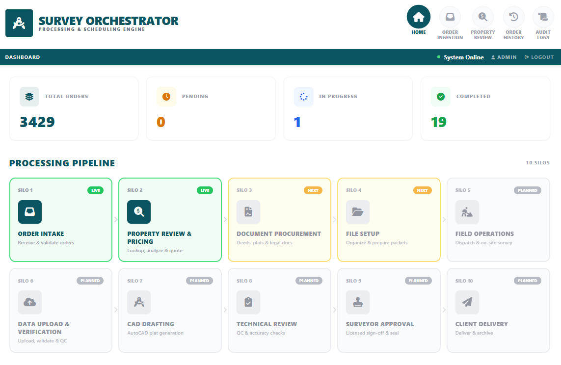
Operations dashboard with real-time order stats and the full processing pipeline. Order Intake and Property Review & Pricing are live, with the remaining stages mapped for future phases.
Results & Impact
Per-order time reduced from roughly 20 minutes of manual research to under 2 minutes
Statewide coverage across every county appraiser, cadastral source, and FEMA flood panel
Staff see the orders that need judgment instead of researching every order from scratch